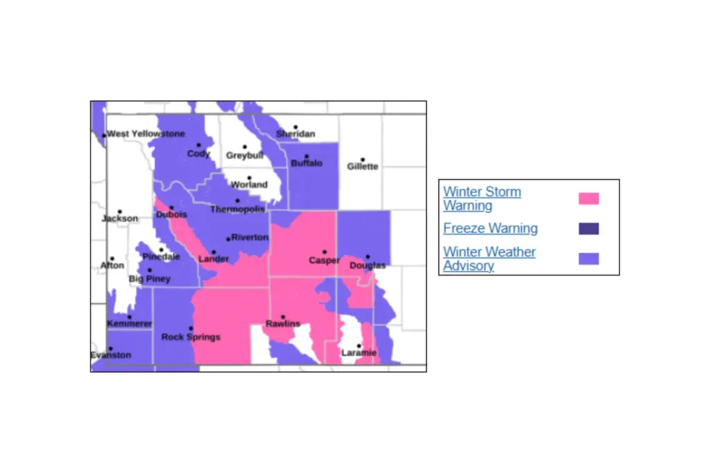
A late-season winter storm is set to bring heavy snowfall—up to 16 inches—along with strong winds and blowing snow across parts of Wyoming, Montana, Utah, Washington, and Oregon, according to the National Weather Service (NWS), which has issued winter storm warnings and winter weather advisories from Sunday into Monday.
Read more MLK Jr.’s Daughter Joins Voting Rights Rally: ‘Protect Our Power’
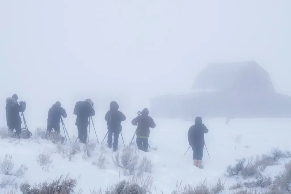
The NWS warns that the winter weather system is likely to create poor visibility and “hazardous conditions” for driving, with impacts expected to disrupt commutes and outdoor activities through Sunday and Monday.
Wyoming Expected to See the Worst Conditions
The latest NWS alerts has a widespread stretch of winter storm warnings and advisories covering mountain ranges, foothills, and some lower elevations across western parts of the U.S.
The most significant impacts are expected in central and northern Wyoming, where a winter storm warning is in effect from Sunday night until Monday night. The Wind River Mountains East could see 8 to 16 inches of snow, paired with wind gusts up to 50 mph, creating near-whiteout conditions at times.
Nearby mountain ranges—including the Green Mountains, Rattlesnake Range, and Casper Mountain—are forecast to get between 6 and 14 inches.
Elsewhere, winter weather advisories extend across:
- The Bighorn Mountains, along the Montana-Wyoming border, which are expected to get up to 10 inches of snow by noon on Monday
- The Uinta Mountains in Utah, with impacts extending into nearby southwest Wyoming, could see up to 14 inches of snow by Monday night.
- Parts of Montana’s Rocky Mountain Front and Glacier region are forecast to get between 2 and 12 inches of snow, especially across higher terrain, by midnight on Sunday
- The Cascades in Washington and Oregon could see anywhere from 1 to 6 inches of snow by early Sunday morning
Strong winds, often reaching 40-50 mph, are expected to produce blowing snow, which will reduce visibility and create difficult conditions, especially across the highest peaks.
Read more Rich Paul Addresses LeBron James Rumors as Lakers Decision Looms
Exactly How Much Snow Is Expected—Forecast Totals
Forecast totals vary significantly by elevation and region, but several areas stand out for higher snow accumulations. These include:
Wyoming (Most Severe Impacts)
- The Wind River Mountains East: 8-16 inches.
- Casper Mountain: 7-14 inches.
- The Green Mountains and Rattlesnake Range, including Jeffrey City: 6-11 inches.
- Natrona County, including the city of Casper: 3-5 inches, locally up to 7 inches.
- The Absaroka and Bighorn Mountain ranges: Typically 4-8 inches, up to 12 inches at higher elevations.
- The Wind River Basin and surrounding areas: 1-4 inches.
Montana
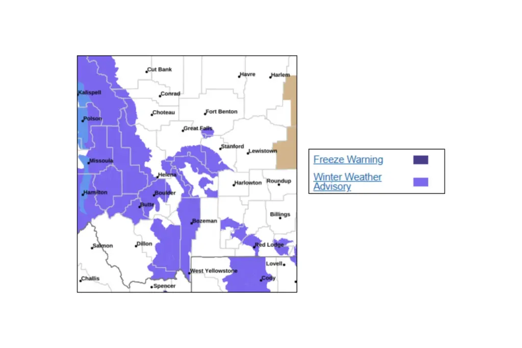
- The Pryor and northern and northeastern Bighorn Mountains (which stretch into Wyoming): 5-10 inches.
- The Rocky Mountain Front and mountain passes: 2-6 inches, up to 12 inches along the highest peaks.
- Red Lodge and Beartooth Foothills: Up to 4 inches.
Utah (Uinta Mountains)
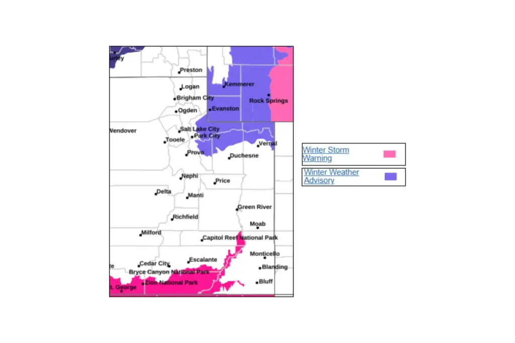
- Western Uinta Mountains: 6-14 inches, with locally higher amounts possible.
- Eastern Uinta Mountains: 6-12 inches above 8,500 feet.
Pacific Northwest (Washington and Oregon)
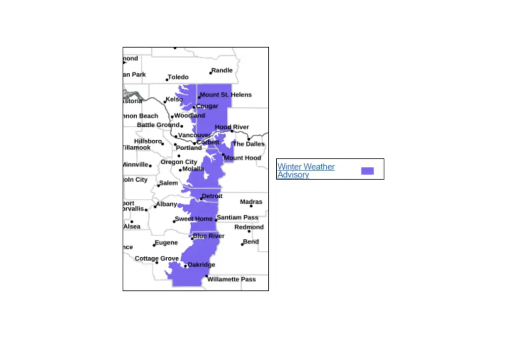
- Washington Cascades: 3 inches above 4,000 feet.
- Oregon Cascades: 1-3 inches above 4,000 feet, with 4-6 inches above 5,000 feet.
Snow Warnings: What Should Drivers Expect?
Travel conditions across the affected states are expected to be dangerous at times, particularly in mountainous terrain and along major corridors.
Key trouble spots include:
- The South Pass in Wyoming, and other high mountain routes in the Wind River range.
- Highway 14 through the Bighorn Mountains
- Interstate 80 in Sweetwater County, Wyoming
- Multiple mountain passes across Montana, including Homestake, Rogers, and MacDonald Passes
- High-elevation routes in the Cascades and Uinta Mountains
Drivers should be prepared for:
- Blowing snow and near-zero visibility.
- Snow-covered, slippery roads, especially across bridges and overpasses.
- Rapidly changing conditions between valleys and higher elevations.
The NWS is urging drivers to slow down, use caution, and carry emergency supplies—such as shovels, torches, blankets, and non-perishable food and drinking water—warning that conditions could worsen quickly, particularly during periods of heavier snowfall and stronger winds.
Commutes and Outdoor Activities Could Be Disrupted
The timing of the winter storm is expected to affect Monday morning and evening commutes across multiple regions, especially in Wyoming and Montana.
Additional local concerns include:
- Backcountry hazards, with cold, wet, and windy conditions, raising the risk of hypothermia.
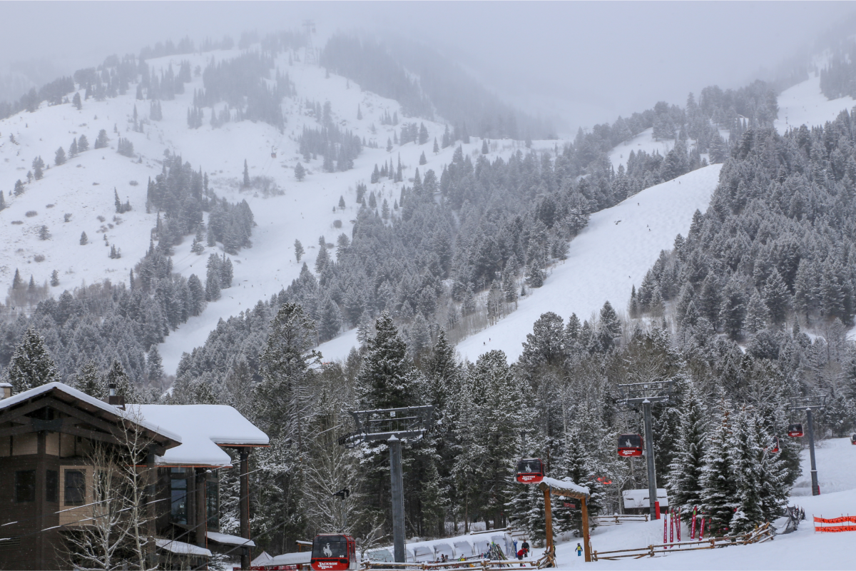
- Difficult conditions for outdoor activities such as walking or skiing, particularly in mountain areas.
- Potential challenges for high-elevation communities, where snow totals will be highest.
In some regions, particularly in the Pacific Northwest, warmer road temperatures may limit snow accumulation on the main roads, but temporary hazardous conditions are still possible during the heavier snow showers.
Read more Timberwolves’ Anthony Edwards Has Shown Who He Is — Believe Him